Tuesday, April 30, 2024

March Agricultural Prices Received Index Up 1.5 Percent; Prices Paid Up 0.6 Percent

March Prices Received Index Up 1.5 Percent  

The March Prices Received Index 2011 Base (Agricultural Production), at 122.3, increased 1.5 percent from February but decreased 4.8 percent from March 2023. At 100.1, the Crop Production Index was down 1.2 percent from last month and 16 percent from the previous year. The Livestock Production Index, at 144.6, increased 2.3 percent from February, and 4.7 percent from March last year. Producers received higher prices during March for cattle, hogs, broilers, and lettuce but lower prices for market eggs, strawberries, oranges, and wheat. In addition to prices, the volume change of commodities marketed also influences the indexes. In March, there was increased monthly movement for cattle, strawberries, milk, and calves and decreased marketing of cotton, soybeans, onions, and apples.  

March Prices Paid Index Up 0.6 Percent  

The March Prices Paid Index for Commodities and Services, Interest, Taxes, and Farm Wage Rates (PPITW), at 140.2, is up 0.6 percent from February 2024 but down 1.1 percent from March 2023. Higher prices in March for feeder cattle, feeder pigs, nitrogen, and gasoline more than offset lower prices for complete feeds, hay & forages, LP gas, and concentrates.  


Idaho And Western United States SNOTEL Water Year (Oct 1) to Date Precipitation % of Normal (4/30)


Monday, April 29, 2024

USDA Weekly Crop Progress Report - Corn 23% Planted, Soybeans 16% Planted; Winter Wheat Condition Drops 1 Point

OMAHA (DTN) -- Corn planting bumped up to 27% of the country's expected planting, five percentage points higher than the five-year planting average, USDA NASS said in its weekly Crop Progress report on Monday.

Soybean planting also is moving ahead of its five-year average over the past week.

A stretch of wetter weather that hit several regions of the country could lead to some row-crop planting facing delays over the next week.

CORN

-- Planting progress: Corn planting moved ahead 4 percentage points last week to reach 27% complete nationwide as of Sunday. That's now four points ahead of the five-year average of 22%.

-- Crop development: 7% of corn was emerged as of Sunday, two points ahead of both last year and three points above the five-year average of 4%.

SOYBEANS

-- Planting progress: 18% of soybeans were planted nationwide as of Sunday. That is two points ahead of last year's pace and is 8 percentage points ahead of the five-year average of 10%.

WINTER WHEAT

-- Crop development: 30% of winter wheat was headed as of Sunday. That is seven points ahead of 23% at this time last year and nine points ahead of the five-year average of 21%.

-- Crop condition: 49% of the crop was rated in good-to-excellent condition, down 1 point from 50% the previous week but still considerably higher than 30% a year ago. Sixteen percent of the crop was rated very poor to poor, down from 43% a year ago.

SPRING WHEAT

-- Planting progress: 34% of spring wheat was planted as of Sunday, 24 points ahead of 10% last year and 15 points ahead of the five-year average of 19%.

-- Crop development: 5% of spring wheat was emerged, three points ahead of 2% last year and equal to the five-year average of 3%.

THE WEEK AHEAD IN WEATHER

Recovering from the rains over the weekend, Farmers in several areas of the country may have to wait for fieldwork this week, according to DTN Ag Meteorologist John Baranick.

"It was very wet over the middle of the country this past weekend, as two storm systems brought a lot of rain and severe weather. The rain was excessive, especially in eastern Kansas and Missouri that saw streaks of 6-10" of rain," Baranick noted.

Planting progress will undoubtedly slow this week in many areas that have seen too much. Other areas that haven't may find delays as well as we see two or three more storm systems moving through over the next week. More heavy rain and severe weather will be on tap in this active pattern.

The southwestern Plains HRW wheat areas have been unfortunate in that rainfall has been scarce in this active pattern. With a storm track mostly north of Kansas, it has been hard to wrap in a bunch of moisture across much of the landscape, leaving these areas with mostly spotty rain that when it has happened, has been met with some larger hail. That again looks to be the case this next week as well and will likely turn HRW wheat conditions lower.

National Crop Progress Summary
This Last Last 5-Year
Week Week Year Avg.
Corn Planted 27 12 23 22
Corn Emerged 7 3 5 4
Soybeans Planted 18 8 16 10
Cotton Planted 15 11 14 14
Winter Wheat Headed 30 17 23 21
Spring Wheat Planted 34 15 10 19
Spring Wheat Emerged 5 2 2 5
Sorghum Planted 19 17 20 20
Oats Planted 63 51 47 51
Oats Emerged 42 35 32 34
Barley Planted 35 24 16 29
Barley Emerged 6 2 2 8
Rice Planted 72 59 60 46
Rice Emerged 48 33 36 28


Bureau of Reclamation, Pacific Northwest Region - Storage Reservoirs in the Upper Snake River (4/29)


Average daily streamflows indicated in cubic feet per second.
Reservoir levels current as of midnight on date indicated.

Upper Snake River system is at 88 % of capacity.
(Jackson Lake,Palisades, Grassy Lake,Island Park,Ririe,American Falls,LakeWalcott)
  
Total space available:477791 AF
Total storage capacity:4045695 AF


Thursday, April 25, 2024

This Week's Drought Summary (4/25)

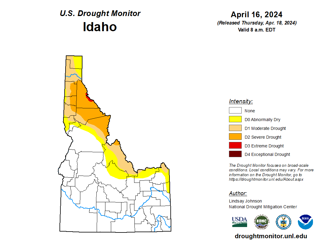
This U.S. Drought Monitor (USDM) week saw improvements on the map in drought-affected areas of the Southwest, Northern Plains, and the Midwest while conditions deteriorated in areas of the Pacific Northwest, Eastern Plains of Colorado and Montana, Southern Plains, and the South. In the Pacific Northwest, a combination of factors (below-normal snowpack conditions, short-term dryness, low streamflows) led to expansion of areas of Abnormally Dry (D0) and Moderate Drought (D1) in western portions of Oregon and Washington. In Montana, poor snowpack conditions in the northwestern and west-central part of the state led to expansion of areas of Extreme Drought (D3) where some SNOTEL stations were reporting record or near-record low snow-water equivalent (SWE) levels. In the Southern Plains, drier-than-normal conditions during the past 30-90-day period in addition to low streamflows, declining soil moisture, and impacts to crops led to expansion of areas of Moderate Drought (D1) and Severe Drought (D2) in Oklahoma and Kansas. Conversely, wetter-than-normal conditions have prevailed during the past 30-60 days in portions of the Midwest leading to widespread improvements across drought-affected areas of Iowa, Minnesota, Wisconsin, and Michigan. Likewise, improvements were made on the map in areas of the Southwest (Arizona and New Mexico) in response to beneficial precipitation received across much of the region since the beginning of the Calendar Year (January 1). In California, snowpack conditions moving into late April (4/24) were near normal levels with the statewide snowpack at 97% of normal, according to the California Department of Water Resources. Elsewhere in the West, below-normal SWE levels have persisted in the mountain ranges of Washington, northern Idaho, Montana, and northeastern Wyoming. According to the Natural Resources Conservation Service (NRCS) SNOTEL network (4/23), region-level (2-digit HUCs) median SWE levels are as follows: Pacific Northwest 75%, Souris-Red-Rainy 76%, Missouri 80%, California 95%, Great Basin 108%, Upper Colorado 87%, Lower Colorado 145%, Rio Grande 78%, and Arkansas-White-Red 79%.


Northeast

For the week, no changes were made on the map with no drought conditions observed across the region. According to NOAA’s National Centers for Environmental Information (NCEI), the Northeast Climate Region observed its wettest December-March period on record as well as its 2nd warmest (average temperature) for the same period. Looking at the longer-term average temperature rankings in the region, the 18-month (Oct 2022-Mar 2024), 24-month (Apr 2022-Mar 2024), 36-month (Apr 2021-Mar 2024), 48-month (Apr 2020-Mar 2024), and 60-month (Apr 2019-Mar 2024) periods all registered warmest on record, according to NOAA NCEI. For the week, average temperatures were above normal across much of the southern extent of the region with departures ranging from 1 to 8+ degrees F above normal with the greatest departures observed in western Pennsylvania and West Virginia. Some pockets of cooler-than-normal temperatures were observed in eastern Pennsylvania, New Jersey, eastern New York, Connecticut, and Vermont. In terms of precipitation, generally dry conditions prevailed with some isolated areas of Upstate New York, Connecticut, Rhode Island, and West Virginia receiving 1-inch accumulations for the week. For the week, no changes were made on the map with no drought conditions observed across the region. According to NOAA’s National Centers for Environmental Information (NCEI), the Northeast Climate Region observed its wettest December-March period on record as well as its 2nd warmest (average temperature) for the same period. Looking at the longer-term average temperature rankings in the region, the 18-month (Oct 2022-Mar 2024), 24-month (Apr 2022-Mar 2024), 36-month (Apr 2021-Mar 2024), 48-month (Apr 2020-Mar 2024), and 60-month (Apr 2019-Mar 2024) periods all registered warmest on record, according to NOAA NCEI. For the week, average temperatures were above normal across much of the southern extent of the region with departures ranging from 1 to 8+ degrees F above normal with the greatest departures observed in western Pennsylvania and West Virginia. Some pockets of cooler-than-normal temperatures were observed in eastern Pennsylvania, New Jersey, eastern New York, Connecticut, and Vermont. In terms of precipitation, generally dry conditions prevailed with some isolated areas of Upstate New York, Connecticut, Rhode Island, and West Virginia receiving 1-inch accumulations for the week.

Southeast

During the past week, light rainfall accumulations (generally < 1 inch) were observed across areas of the region with the highest accumulations (2 inches) observed in isolated areas of Alabama, Georgia, and the Carolinas. Average temperatures were above normal (3 to 9 degrees F) in areas of north-central Florida, eastern Georgia, and the Carolinas, while temperatures were slightly below normal in Alabama. In North Carolina, short-term dryness (past 30-90-day period) and declining streamflow levels (< 24th percentile) led to expansion of areas of Abnormally Dry (D0) in the central part of the state. Likewise, areas of D0 were introduced in central and southwest Florida in response to below-normal precipitation (past 60-days) and deteriorating soil moisture and streamflow conditions. Overall, drought-free conditions (not including D0 areas) have prevailed across the region for three consecutive weeks.

South

In the South, light-to-moderate rainfall (up to 4 inches) was observed across isolated areas of the region during the past week with the heaviest accumulations logged in eastern Texas, northern Louisiana, southwestern Arkansas, and central Mississippi. For the week, average temperatures were near to slightly above normal in southern portions of Texas and Louisiana, while areas in the northern half of the region were generally cooler-than-normal (1 to 8 degrees F). On the map, conditions deteriorated in areas of the South Texas Plains and Edwards Plateau in response to a combination of factors including short-term dryness (past 30-90 days), low streamflows, declining soil moisture levels, and stressed vegetation. In terms of water supply, statewide reservoir conditions in Texas were at 73.9% full (4/24). However, some lingering low reservoir conditions are being reported in the western half of the state in the San Angelo and San Antonio areas, according to Water Data for Texas. In Oklahoma, dry conditions led to another round of degradations on the map across the northern portion of the state. According to the latest U.S. Department of Agriculture (USDA) Oklahoma Crop Progress and Condition report (4/21/24), the statewide soil moisture (topsoil) condition was rated 46% short to very short. In northwestern Tennessee, reductions in areas of Abnormally Dry (D0) and Moderate Drought (D1) were made in response to precipitation during the past 30-day period.

Midwest

For the week, light-to-moderate precipitation accumulations (generally < 2 inches) were observed in the region with the heaviest accumulations logged in isolated areas of southern Minnesota, southern and northeastern Iowa, southeastern Missouri, southern Illinois, and southwestern Indiana. Average temperatures for the week were below normal (2 to 6 degrees F) across the western half of the region with the greatest anomalies observed in eastern Iowa and central Illinois. In the eastern portion of the region, the average temperature hovered within a few degrees of normal. On the map, improvements were made in drought-affected areas of southern Minnesota, eastern and northern Iowa, northern Missouri, Wisconsin, southern Illinois, and northern Michigan. In Iowa, despite improving conditions, two areas of Extreme Drought (D3) remain in the northeastern part of the state due to the lingering impacts of the longer-term drought situation with 12-month precipitation deficits ranging from 12 to 16 inches. According to the latest USDA Iowa Crop Progress and Condition report (4/22/24), the statewide soil moisture (topsoil) condition was rated 37% short to very short and 60% adequate. In southern Missouri, areas of drought expanded on the map where dry conditions have prevailed in the shorter term (past 30-90 days) and have led to a significant decline in streamflow levels with numerous rivers and creeks reporting very low flows during the past week (< 10th percentile), according to the U.S. Geological Survey (USGS). Moreover, very low soil moisture levels (< 10th percentile) are showing up on various NASA SPoRT soil moisture products.

High Plains

On this week’s map, one-category degradations were made in Kansas where precipitation has been below normal during the past 90-day period with the greatest departures (4 to 5 inches) observed in south-central and eastern Kansas. Moreover, stream gages on numerous creeks and rivers in central and eastern Kansas were reporting much below-normal flows (< 10th percentile), according to the USGS. In terms of impacts, the USDA reported (4/21/24) that 26% of the winter wheat crop in Kansas was rated in poor to very poor condition. In addition to dry conditions, average temperatures across the Plains states have been well above normal levels (ranging from 4 to 8+ degrees F) during the past 90 days with the greatest anomalies observed in far eastern portions of the region. In North Dakota Climate Division 6 (East Central Division), the December-March period was the 2nd warmest on record with an +11.6 degrees F anomaly, according to NOAA NCEI. In northeastern Nebraska and northwestern South Dakota, shorter-term improvements in drought-related conditions led to reductions in areas of Abnormally Dry (D0) and Moderate Drought (D1). For the week, average temperatures were below normal (2 to 10+ degrees F) with the greatest departures observed in western portions of the Dakotas and Nebraska as well as along the eastern plains of Wyoming and Montana. Overall, the region was generally dry during the past week except for a few areas that benefitted from isolated shower activity in northeastern Kansas, north central and northeastern Nebraska, and southwestern South Dakota.


West

On the map, improvements were made across areas of central and southeastern Arizona and in southern New Mexico in response to a re-assessment of overall conditions looking at numerous drought metrics at various time scales. Since January 1, much of Arizona as well as western and northern portions of New Mexico have observed precipitation levels ranging from normal to well above normal. In contrast, below-normal precipitation has prevailed across much of eastern New Mexico. Looking at SWE levels (April 1) from the NRCS SNOTEL network, all basins (6-digit HUC) within Arizona and New Mexico were above normal. Elsewhere in the region, areas of Abnormally Dry (D0) were introduced in western Oregon and Washington in response to short-term dry conditions and very low streamflow levels that have significantly dipped in recent weeks. In Montana, poor snowpack conditions led to further degradations on the map.


Caribbean

In Puerto Rico, wet conditions this week led to removal of an area of Abnormally Dry (D0) and Moderate Drought (D1) in eastern Puerto Rico, leaving only one remaining area of lingering drought in the northwestern portion of Puerto Rico.

This week, near-normal conditions continued across the U.S. Virgin Islands. On St. John, rainfall amounts reported at VI-SJ-4 (Cruz Bay 0.8 NE) and VI-SJ-5 (Cruz Bay 1.6 E) were 2.02 and 1.05 inches, respectively. In addition, VI-SJ-3 (Windswept Beach) observed 2.56 inches of rain during the USDM week. Experts reported that rainfall this month (April) is up to 3.63 inches as of the data cutoff for this week, with more than half of that total falling early in the week. This marks the wettest April in this location since 2008, when 3.79 inches fell for the entire month. The depth to water level at Susannaberg DPW 3 well (St. John, USVI) on April 23, 2024 was 11.19 ft below land surface, which has slightly decreased this week due to the recent rains. So, St. John remained free of drought.

On St. Croix, heavy showers were observed this week. The weekly rainfall amount across the island ranged from 3.30 inches at VI-SC-35 (Frederiksted 1.3 ENE) to 5.41 inches at VI-SC-30 (Christiansted 1.7 SW). Intermediate values included 4.77 inches at VI-SC-10 (Christiansted 1.6 E), 3.79 inches at VI-SC-20 (Frederiksted 1.7 ESE), 5.05 inches at VI-SC-23 (Christiansted 6.5 W), 4.23 inches at VI-SC-25 (Christiansted 4.4W), 3.32 inches at VI-SC-29 (Frederiksted 2.5 NNE) and 3.38 inches at VI-SC-34 (Frederiksted 1.9NE). Because of heavy rains in recent days, the depth to water level at Adventure 28 Well (St. Croix, USVI) on April 23, 2024 was 27.78 ft below land surface, decreasing from last week (30.42ft). Thus, St. Croix remained drought free.

On St. Thomas, rainfall totals this week ranged from 0.17 inch at VI-ST-14 (Nadir 0.3E/Tropical Marine) to 1.89 inches at VI-ST-5 (Charlotte Amalie West 4.2 WNW). In addition, 1.12 inches of rain was reported at VI-ST-13 (Charlotte Amalie 1.2 NNW). Also, Cyril E King AP reported 0.17 inches of rain this week. Due to recent rains, the depth to water level at Grade School 3 well (St. Thomas, USVI) observed on April 23, 2024 was 8.52 ft below land surface, decreasing from last week (10.35 ft). However, St. Thomas remained in long-term abnormally dry conditions (D0-L) this week.

Pacific

In Alaska, conditions on the map remained status quo with no drought conditions observed.

In the Hawaiian Islands, some improvements were made on the map in Kauai, Oahu, and Maui where recent rainfall has improved conditions. Over the past 30-day period, above-normal rainfall has been observed across Kauai and Oahu as well as areas of Molokai and Maui, according to reanalysis data from the NOAA NCEP Climate Forecast System (CFS) model and observational data. For the week, average temperatures were 1 to 4 degrees below normal across the Hawaiian Islands with the exception of the Big Island, which observed warmer-than-normal temperatures (1 to 5 degrees F).

Wet conditions continued across the Marshall Islands this week. Ailinglapalap reported 1.44 inches of rain, remaining in short-term abnormally dry conditions. This week, Jaluit received only 0.54 inches of rain, remaining free of drought due to the wet conditions in the previous weeks. Majuro reported 2.21 inches of rain this week. Last week the weekly total rainfall was 3.54 inches. In addition, the reservoir level reported at Majuro is increasing (i.e., it reached about 21 million gallons). Thus, Majuro improved to short-term severe drought conditions this week. This week, drier-than-normal conditions continued on Wotje, which reported only 0.32 inches of rain. Thus, Wotje remains in short- and long-term extreme drought conditions. On Kwajalein, 2.12 inches of rain was reported this week. Even though Kwajalein had wet conditions this week, the island remained in short-term moderate drought due to little (less than 2 inches) weekly total rainfall in the past four weeks. No depiction was made for Milli and Utirik due to missing data.

South and eastern Micronesia received heavy showers this week. Pingelap reported 5.97 inches of rain this week with one day missing and improved from abnormally dry to drought free conditions. In addition, Woleai received 2.21 inches of rain this week, improving from extreme to severe drought conditions. Heavy showers were observed on Pohnpei, Kosrae, Lukunoch and Nukuoro, reporting 11.42, 4.78, 3.12 and 2.03 inches of rainfall this week, respectively. Thus, these locations remained free of drought. Though Kapingamarangi received no rain this week, the island remained free of drought due to wet conditions in the past three weeks.

On Ulithi, 1.44 inches of rain was reported this week. However, because Ulithi had drier-than-normal conditions for the past few weeks, it remained in the short-term exceptional drought category. Similarly, Yap received 1.36 inches of rain this week, so the island remains in short-term exceptional drought conditions. On Chuuk, 1.48 inches of rain (one day missing) was observed this week, allowing the island to remain in abnormally dry conditions. No depiction was made for Fananu due to missing data.

Normal conditions continued across American Samoa. Pago Pago reported 2.16 inches of rain this week, remaining free of drought. In addition, Siufaga Ridge and Toa Ridge observed 2.19 and 1.10 inches of rain this week, respectively.

Wet conditions prevailed across Palau. Heavy scattered showers (7.70 inches of rain) were reported on Palau IAP (Airai) this week. Koror COOP station also reported 4.414 inches of rain, and the island improved to drought-free conditions this week.

Even though some heavy scattered showers were observed late in the week, dry conditions remained across the Mariana Islands during most parts of this week. The weekly rainfall total report showed that only 0.02 inches of rain was observed on Saipan (IAP, manual gauge) this week. Also, Saipan (ASOS) received only 0.11 inches of rain. Thus, Saipan remained in extreme drought conditions. Rota received only 0.15 inches of rain (one day missing) to remain in short-term moderate drought. On Guam, no rain was reported this week, and the island remains in extreme drought conditions. Late reports showed that heavy rainfall events are in progress on Guam that could change the current drought situation in the coming days.

Looking Ahead

The NWS Weather Prediction Center (WPC) 7-Day Quantitative Precipitation Forecast (QPF) calls for moderate-to-heavy precipitation accumulations ranging from 2 to 5+ inches (liquid) across western Washington and Oregon as well as eastern portions of the Southern and Central Plains and lower Midwest. Lighter accumulations (< 2 inches) are expected in areas of the Central and Northern Rockies and Upper Midwest, while isolated light shower activity is expected in portions of Northern California, the Great Basin, and the Northeast. The NWS Climate Prediction Center (CPC) 6-10 Day Outlooks call for a moderate-to-high probability of above-normal temperatures across most of the conterminous U.S., with the exception of the Far West, and the western Great Basin where cooler-than-normal temperatures are expected. In Alaska, there is a low-to-moderate probability of above-normal temperatures in the southern half of the state and below-normal temperatures north of the Brooks Range. In terms of precipitation, below-normal precipitation is expected across the Eastern Tier of the conterminous U.S. as well as out West in western Colorado, Utah, and southern Nevada. Elsewhere, there is a high probability of above-normal precipitation across the Pacific Northwest, Northern California, eastern New Mexico, Texas, the Plains states, and the Upper Midwest.


Monday, April 22, 2024

USDA Crop Progress - Corn 12% Planted, Soybeans 8% Planted; Winter Winter Condition Drops 5 Points

 OMAHA (DTN) -- The winter wheat crop's good-to-excellent condition rating dropped 5 percentage points nationwide last week, likely due to dry conditions and possible frost damage in some areas, USDA NASS said in its weekly Crop Progress report on Monday. Meanwhile, corn and planting progress continued ahead of their five-year average paces last week.

A stretch of wetter weather forecast to begin later this week and continue into early May could flip the situation, though, with winter wheat benefiting from the moisture but row-crop planting facing delays.

CORN

-- Planting progress: Corn planting moved ahead 6 percentage points last week to reach 12% complete nationwide as of Sunday. That's now equal to last year's progress and 2 points ahead of the five-year average of 10%. "Texas corn is 68% planted and Missouri is 47% done, while major corn-producing states Iowa and Illinois are 13% and 11%, respectively," said DTN Senior Analyst Dana Mantini.

-- Crop development: 3% of corn was emerged as of Sunday, 1 point ahead of both last year and the five-year average of 2%.

SOYBEANS

-- Planting progress: 8% of soybeans were planted nationwide as of Sunday. That is equal to last year's pace and is 4 percentage points ahead of the five-year average of 4%. "Louisiana's soybean crop is 42% planted compared to the average of just 25%, and Mississippi is 28% planted -- 5 percentage points above the average," Mantini noted. "Illinois is 11% planted, and Iowa is just 8% planted."

WINTER WHEAT

-- Crop development: 17% of winter wheat was headed as of Sunday. That is 1 point ahead of 16% at this time last year and 4 points ahead of the five-year average of 13%.

-- Crop condition: 50% of the crop was rated in good-to-excellent condition, down 5 points from 55% the previous week but still up from 26% a year ago. Sixteen percent of the crop was rated very poor to poor, down from 41% a year ago. "Major winter wheat producer Illinois' crop is rated 83% good to excellent, with Kansas' crop at 36% good to excellent and 26% rated poor to very poor," Mantini said.

SPRING WHEAT

-- Planting progress: 15% of spring wheat was planted as of Sunday, 11 points head of 4% last year and 5 points ahead of the five-year average of 10%. "Washington's spring wheat is 60% planted, and Idaho is 55% planted," Mantini said. "Minnesota is 18% planted, well ahead of its 3% average, while North Dakota is just 7% planted. South Dakota, at 40% planted, is well ahead of its 21% average."

-- Crop development: 2% of spring wheat was emerged, 1 point ahead of 2% last year but 1 point behind the five-year average of 3%.

THE WEEK AHEAD IN WEATHER

Farmers across the nation's midsection will have a few suitable days for fieldwork this week before an extended period of wet weather sets in, according to DTN Ag Meteorologist John Baranick.

"A very active pattern is about to set up across the middle of the U.S., and that's going to bring some very wet weather to much of the Plains and Midwest later this week and probably the first half or so of May," Baranick said. "I will never tell farmers what to do, but if they have some time over the first half of this week to get some work done, I would take the opportunity. It might be hard to find better conditions for a while.

"What is going to change is that a ridge will generally build over the East while we see system after system in the pipeline move into the West, develop, and then move from the Central or Southern Plains through the Midwest and Great Lakes. That overall background situation is what will drive multiple storm systems to move through ag country starting on Thursday and then come at a rapid pace for at least two weeks. These systems will come with widespread showers and thunderstorms, heavy rain, severe weather, and strong background winds, creating hazards for fieldwork and potentially for winter crops. At the same time, this rain is needed over most of the Plains and western Midwest, so it is a kind of double-edged sword.

"Not all areas will get heavy rain out of each storm. But with breaks likely being short-lived, this could push back progress a bit into May. That is not overall a bad thing for most areas, but it could have an impact.

"Winter wheat producers in the southwestern Plains finally have some really good chances at meaningful rain. It may not be perfect, but the setup does favor increased and above-normal precipitation over the next couple of weeks."


National Crop Progress Summary
This Last Last 5-Year
Week Week Year Avg.
Corn Planted 12 6 12 10
Corn Emerged 3 NA 2 2
Soybeans Planted 8 3 8 4
Cotton Planted 11 8 11 11
Winter Wheat Headed 17 11 16 13
Spring Wheat Planted 15 7 4 10
Spring Wheat Emerged 2 NA 1 3
Sorghum Planted 17 14 17 18
Oats Planted 51 43 40 42
Oats Emerged 35 30 27 28
Barley Planted 24 11 9 19
Barley Emerged 2 NA 1 3
Rice Planted 59 44 47 35
Rice Emerged 33 18 27 20

**

National Crop Condition Summary
(VP=Very Poor; P=Poor; F=Fair; G=Good; E=Excellent)
This Week Last Week Last Year
VP P F G E VP P F G E VP P F G E
Winter Wheat 5 11 34 43 7 4 9 32 47 8 18 23 33 23 3


Bureau of Reclamation, Pacific Northwest Region - Storage Reservoirs in the Upper Snake River (4/22)


Average daily streamflows indicated in cubic feet per second.

Reservoir levels current as of midnight on date indicated.

Upper Snake River system is at 88 % of capacity.
(Jackson Lake,Palisades, Grassy Lake,Island Park,Ririe,American Falls,LakeWalcott)
  
Total space available:487835 AF
Total storage capacity:4045695 AF


Thursday, April 18, 2024

This Week's Drought Summary (4/18)

Heavy precipitation fell across much of the central and eastern parts of the country, bringing improvements along the Mississippi River and Great Lakes regions. There were also isolated areas of improvement in Oregon, Idaho and Montana. Extreme drought conditions were introduced in the mountainous region along the Idaho and Montana border due to concerns about low snow amounts and possible early snowmelt. Across the country in the Southeast, areas in North Carolina and southern Florida are seeing drying conditions due to low precipitation over the past few weeks. Western and southern Texas, which largely missed this week’s precipitation, saw an expansion of abnormal dryness, moderate and severe drought conditions. Flash drought conditions are appearing in Oklahoma, and Kansas, with some spillovers in eastern Colorado and western Missouri. Weeks with little precipitation, warming temperatures, dry soils and low streamflow levels are leading to rapid degradations.


Northeast

The large precipitation events that brought heavy rain across the South and into the Northeast helped improve what little dry and drought conditions remained. In western New York, moderate drought was removed. New York and surrounding areas are also seeing good streamflows and soil moisture. Nantucket was finally relieved of the lingering moderate drought, leaving abnormally dry conditions.

Southeast

There was more precipitation this week clearing up lingering abnormal dryness along the Gulf Coast. Eastern North Carolina and southern Florida missed out on this week's round of precipitation, adding to the lack of precipitation for the past 14 to 30 days, which saw the introduction and expansion of abnormal dryness.

South

Heavy precipitation fell across eastern Texas, Louisiana, southern Arkansas and west-central Mississippi. This brought improvements in northeast Mississippi, leaving the state drought-free with only some lingering abnormally dry conditions. While less precipitation fell in Tennessee, the western part of the state also saw improvements. Conversely, southern Texas and Oklahoma are seeing conditions worsen as conditions continue to quickly deteriorate. Conditions in Oklahoma into Kansas are seeing rapid degradation and short-term dryness indicating flash drought conditions.

Midwest

Conditions across the Midwest continued to improve, except for western Missouri and a small area in western Michigan. The central and eastern parts of the Midwest received 1 to 2.5 inches of rain, bringing improvements to Missouri, Illinois, Indiana and the Kentucky border. Eastern Iowa also saw slight improvements due to improved conditions over the past 30 to 90 days, though longer-term conditions of 6 months or more are still showing dryness. Western Missouri missed out on the precipitation, further degrading already dry conditions similar to Kansas and Oklahoma.

High Plains

The southern High Plains are in the grips of rapidly drying conditions, leading to degradations across Kansas, with conditions bleeding into eastern Colorado and southern Nebraska. Western Kansas has not seen precipitation in over two weeks, providing no relief to the rapidly drying soils and low streamflows. Conditions in Kansas into Oklahoma are seeing rapid deterioration and short-term dryness indicating flash drought conditions.


West

The West saw conditions remain mostly the same, with areas in the Northwest seeing some improvements. Regions along the Pacific coast received some precipitation but not in areas needing moisture. There was some improvement in southern Oregon where precipitation did fall. Southern Idaho also saw improvement with the precipitation and decent snowpack. Northern Idaho into Montana did see some degradation, with mountainous areas seeing snow at extremely low levels. Western Montana experienced improvements in the east-central part of the state.


Caribbean

Puerto Rico is currently experiencing a wet pattern bringing continuing improvements in the southwest and southeastern parts of the island where abnormal dryness (D0) was removed.

On St. Croix, the weekly rainfall amount ranged from 1.35 inches at VI-SC-30 (Christiansted 1.7 SW) to 3.90 inches at VI-SC-35 (Frederiksted 1.3 ENE). Intermediate values included 1.37 inches at VI-SC-10 (Christiansted 1.6 E), 2.72 inches at VI-SC-20 (Frederiksted 1.7 ESE), 1.44 inches at VI-SC-23 (Christiansted 6.5 W), 1.37 inches at VI-SC-25 (Christiansted 4.4W), 1.52 inches at VI-SC-29 (Frederiksted 2.5 NNE), and 1.83 inches at VI-SC-34 (Frederiksted 1.9NE). Due to the recent rains, the depth to water level at Adventure 28 Well (St. Croix, USVI) on April 16, 2024 was 30.42 ft below land surface decreasing from last week (30.74 ft). Thus, St. Croix remained free of drought.

On St. John, rainfall amounts reported at VI-SJ-5 (Cruz Bay 1.6 E) and VI-SJ-9 (Trunk Bay 0.2 W) were 1.27 and 0.51 inches, respectively. In addition, VI-SJ-3 (Windswept Beach) observed 0.99 inches of rain. The depth to water level at Susannaberg DPW 3 well (St. John, USVI) on April 16, 2024 was 11.86 ft below land surface., which has slightly increased this week as compared to last week (i.e., 11.67 ft). However, the yearly graph shows relatively a shallow depth resulting St. John to remain free of drought for this week.

Pacific

On St. Thomas, rainfall totals this week ranged from 0.5 inch at VI-ST-15 (Charlotte Amalie West 1.3N) to 2.02 inches at VI-ST-5 (Charlotte Amalie West 4.2 WNW). In addition, at VI-ST-13 (Charlotte Amalie 1.2 NNW), 1.66 inches of rain was reported. The depth to water level Grade School 3 well (St. Thomas, USVI) on April 16, 2024 was 10.35 ft below land surface, which is an increase in depth to water level as compared to last week (i.e., 7.03 ft). This shows the persistence of abnormally dry conditions. Thus, St. Thomas remained in D0-L (long-term abnormally dry category).

There were no changes made in Alaska this week.

Hawaii had significant rain events late last week (April 11-14). Kauai got 10 to 12 inches over Thursday evening (April 11). The second round of storms brought a further 1 to 3 inches of precipitation over most of the islands, leading to improvements on all but the Big Island.

Wet conditions prevailed across most parts of the Marshall Islands this week. Jaluit reported 4.12 inches of rain, resulting in drought-free conditions. Also, Ailinglapalap received heavy showers (5.51 inches of rain) this week, improving from moderate drought to abnormally dry conditions. Even though Majuro reported 3.54 inches of rain, the island remained in short-term extreme drought due to below-normal weekly rainfall (less than 2 inches) for the past nine weeks. This week, no rain was reported on Wotje, so the island remained in short- and long-term extreme drought conditions. Similarly, no rain was reported on Kwajalein, with 2 days missing, and it remained in short-term moderate drought conditions. No depiction was made for Milli and Utirik due to missing data.

This week, the dry trade-wind pattern continued with generally spotty light showers, worsening drought conditions. Only a few locally moderate to heavy showers were observed across western Micronesia south of 10°N latitude, as the current El NiƱo drought holds its grip across the islands. On Ulithi, 0.01 inches of rain with two days missing was reported this week. Because Ulithi received less than 2 inches of rain for consecutive eleven weeks, the island deteriorated to short-term exceptional drought. Similarly, Yap received only 0.01 inches of rain (with one day missing) to remain in short-term exceptional drought.

In contrast, wet conditions were observed on Lukunoch, Nukuoro, Pohnpei and Pingelap, reporting 4.15, 3.93, 3.39 and 2.23 inches of rainfall this week, respectively. These locations remained free of drought. Kapingamarangi and Kosrae reported 3.47 and 1.90 inches of rain, respectively, to remain free of drought. On Chuuk, 5.38 inches of rain was observed this week, allowing the island to improve from moderate drought to abnormally dry conditions.

Normal conditions prevailed across American Samoa. Pago Pago reported 2.54 inches of rain this week, remaining free of drought. In addition, Siufaga Ridge and Toa Ridge observed 3.18 and 2.28 inches of rain this week, respectively.

Heavy scattered showers were reported on Palau this week. Palau IAP (Airai) reported 2.99 inches of rain this week. Koror COOP station also reported 1.74 inches of rain. However, due to drier-than-normal conditions in the past few weeks, the island remained in short-term abnormally dry conditions.

This week, dry conditions continued across the Mariana Islands. On Saipan, only 0.80 inches of rain was observed this week. In addition, Saipan (ASOS) received only 0.48 inches of rain. Thus, Saipan deteriorated to extreme drought conditions. Also, Rota received weekly totals of only 0.041 inches of rain (one day missing) to remain in short-term moderate drought. On Guam, only 0.30 inches of rain (with one day missing) was reported this week, and the island deteriorated to extreme drought conditions. Reports showed that Guam International Airport’s Keetch-Byram Drought Index (KBDI) has slightly increased to 704, which is in the high range.

Looking Ahead

Over the next 5 days (April 19-23), more heavy precipitation is expected in the Plains and Midwest. Iowa, Nebraska and South Dakota could see upwards of 2.5 inches of precipitation. Northeast Texas, southeastern Oklahoma, and western Arkansas could see 1.5 to 2 inches of precipitation. Areas of higher elevation in the Rockies of Colorado and Wyoming are also expected to see between 1-2 inches.

The National Weather Service Climate Prediction Center’s 6 to10-day outlook (Valid April 22) favors above-normal precipitation for southern parts of the U.S., particularly along the eastern Gulf Coast from Texas and Louisiana into parts of Arkansas and Oklahoma. Florida is also favoring above-normal precipitation. The Northwest and Northeast are leaning towards below-normal precipitation. From the middle of Pennsylvania northward, below-normal precipitation is likely to occur. Hawaii is also leaning towards below-normal precipitation and Alaska is leaning towards above-normal precipitation. In terms of the temperature outlook, above-normal temperatures are expected from the West into the High Plains, as well as along the Gulf Coast and Florida. Utah, Nevada, northern Arizona, northern New Mexico and western Colorado are showing a 70-80% likelihood of above-normal temperatures. Eastern Alaska is also leaning towards above-normal temperatures. The Mid-Atlantic region and the eastern Midwest are leaning toward below-normal temperatures. Hawaii and western Alaska are favoring below-normal temperatures.


This Week's Drought Summary (5/2)

During the late week and weekend, a large severe weather outbreak brought large hail, damaging winds and numerous intense tornadoes to parts...